Archive for the ‘Wrangell-St Elias National Park’ Category

Nabesna Road – Wrangell-St Elias Park July 1-3, 2009

Monday, July 6th, 2009

We left Tok and drove to the northern entrance to Wrangell-St Elias Park.

Along the way, we stopped for a couple of short hikes. A park ranger suggested we take one trail and handed us a bear spray can just in case we ran into a brown bear that had been spotted in area.

When we got there, we parked our rig at a campsite in Porcupine Campground and went to the Slana Ranger station. The people there were very helpful and offered us coffee. We found out that the 1st 26 miles of Nabesna road had a fairly good road surface. We were advised not to go the rest of the way since our car was too low to the ground. Two days later, we ignored this advice and paid the consequences. The lead ranger mentioned there was a good primitive campsite at the six mile mark. We decided to take a drive down to that campsite to check it out.

As we started into the park, we saw a confederate flag flying over a wooded section. We later met the true Alaskan who owned the property. He had cut his thigh with a chain saw. He let us know how independent and self dependent he was! He started the Slana Alaskans Unite Movement.

MILEPOST PHOTO SHOOT

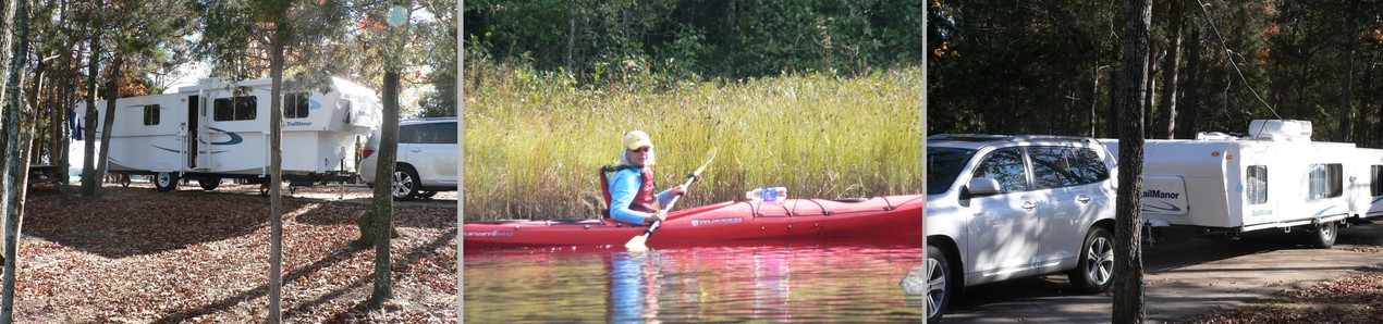
We loved the campsite at 6.1 miles into park on Nebesna Road. It had a picnic table and fire ring. The site was set back into the woods with Rufus Creek running just behind it.

There was no water source other than the creek and no outhouse. There was also no cost for staying here.

We set up camp. We collected wood which was readily available, started a campfire and sat around fire with our wine and cheese before our evening meal.

After a few minutes, a trucker camper came up the road and stopped next to the entrance to our campsite. We walked over to let the people know that we could move our car to make room for them to stay. They said they came to take our pictures for Milepost Travel Guide!

The woman was a photographer for the Milepost. She wanted to take pictures of peopel camping at this site since it was one of the best camping spots in the Alaskian interior. She proceeded to take photo’s of our camper, the creek and us having our wine around the camp fire.

Milly and I looked at each other and laughed. We are in the middle of no where.

The Milepost is the Alaskan Travel Guide that everyone buys who drives to British Columbia, Yukon and Alaska. It gives you information about camp sites, fuel stops, attractions along each highway. It is indespensible. Now, Milly and Fred maybe in next years issue or the corresponding newsletter!

HIKE

The next morning, we hiked the Caribou Trail – 7 mile round trip located about 20 miles into the park.

TO END OF NABESNA ROAD!

The following day we planned on paddling twin lakes at the 26 mile mark. When we got there, the access road was far too rutted for us to get though. We decided to drive to the first creek fording location to see if we could get across and perhaps drive to the end of the Nabesna Road. When we got there, we checked the depth of the water. We decided to give it a try. The first crossing was really two separate crossings.

We had to cross two other locations before we got to the end of the road. The views were great and different as the valley narrowed. What we found at the end of the road was a small airport and B&B rustic style. We turned around and went back. The 46 miles back dragged.

We knew the rear end of car had hit the rocked creek bottom a couple of times during out creek crossings. We discovered that the hitch electrical connection was now parallel to the ground instead of perpendicular. When we got back to camper, we tried to make the connection. It wouldn’t fully engage. Fred adjusted some connection points and we were ok. We now have an improved connection configuration.

Milly has stated there will be no more adventureous driving!

We decided to go to Valdez on the 4th of July. After Valdez, we will go to McCarthy at end of the southern entrance road into the park. We are going to stay at a lodge there for 2 days. We plan on leaving our camper at a primitive campsite

Valdez July 4th Celebrations

Monday, July 6th, 2009

When we left Wrangell-St Elias to head for Valdez, our gas was down to a quarter tank. We had burned at lot of gas going back and forth into the park the last 3 days. We did have an extra 5 gallon tank just in case. We arrived at gas station with low gas light on.

When we got to Glennallen, we were told about their noontime July 4th community salmon bake behind the library. We went. It was very interesting to see a small Alaskan community celebrate the 4th in a picnic atmosphere. We had plenty of salmon, hot dogs, corn on the cob, baked potatoes, etc., sitting on the playing field watching the youth play Ultimate Frisbee. There was no charge! We made a donation to local Lions Club who put on the feast.

When we got to the RV park in Valdez about 4 pm, we were told of the Salmon Bake potluck that they were having at 6 PM. Since we got there late, we were exempted from bringing something. The owner used to be a commercial salmon fisherman. He often swaps cases of beer with his friends for garbage cans full of salmon for his RV Salmon Bakes.

The noontime salmon was cooked is smokers. The evening salmon was grilled with blacken spices. The food at the potluck was fabulous. Milly appreciated not having to prepare food for the day.

The evening fireworks seemed to last forever. People had their own and started blasting about 8 pm. The noise didn’t stop until well past midnight. We heard the town fireworks go off but had already settled into bed.

Worthington Glacier & Chitina 07/07-08/2009

Monday, July 13th, 2009

We left Valdez on the morning of July 7th travelling on Edgerdown Highway with McCarthy in Wrangell-St Elias National Park as our ultimate destination. We thought we were going to stay at Blueberry Lake State Park for a night while we visited Worthington Glacier.

We passed through Keystone Canyon and Bridal Falls. We drove through Blueberry Lake area. The lake was small and uninteresting. We decided to visit the glacier and head to a primitive campground at Chitina at the beginning of McCarthy Road. We parked our camper at Chitina campsite for 5 days. We stayed there the nights of the 7th and 8th. We also stayed there on 11th when we came back from staying the 10th and 11that Ma Johnson’s, a historic lodge in McCarthy. This posting concerns itself with the trip to Chitina and our initial day there with the salmon fishermen.

The trip continued to be plagued by smoke haze from fires burning in Alaska. This impacted our ability to get quality scenic pictures of the mountain views.

When we arrived in Chitina, we found a very small town on the Cooper River. There was a gas station with small grocery section, a liquor store, a couple of gift shops, post office, a visitors center and a ranger station. Chitina is the starting point of the McCarthy Road, which is a 60 mile Alaskan gravel road that leads to the historic towns of McCarthy and Kennicott.

The Cooper River is full of glacier silt and is very fast flowing. The river delta area around Chitina was full of silt blown by the strong winds that often occur there. Our primitive campground has inches of silt on the ground. Walking around there was like walking on moons surface. You were always kicking up dust.

Our campsite was setup by the state. There were picnic tables, fire rings and vault toilets. There was no water. You had to bring your own water or get refills in Chitina about a mile away. It was on one side of the road. On the other side were the salmon fish wheels, dip net fishing areas and a campground area maintained by the native tribes.

It was fasinating to see the different homemade fish wheels in operation. Each was unique but operated with strong current pulling the scoop nets around and around. We could see where the “caught” salmon would fall to the side into container as the net turned around. The fisherman all had the campers parked in random locations around the delta. There with ATVs all over the place. Alaskans call them over land vehicles.

Comments on talking to Alaskans: Sarah is a true Alaskan and she is loved by most of these people. Don’t mention Obama. They are true conservatives up here!

McCarthy Road/Hikes Wrangell-St Elias Park July 9-11,2009

Tuesday, July 14th, 2009

On July 8th, we travelled up the first 12 miles of McCarthy Road to hike into 3 lakes looking for somewhere to paddle. We couldn’t find a location close enough to road to get kayaks to lake.  This section of the road was probably the roughest part of the whole road. We had decided not to take our camper on this road. We planned to stay at a lodge in McCarthy and enjoy restaurant meals for 2 days while we visited  the Kennicott Copper Mine and took a guided tour on the Root Glacier.

McCarthy is a town about 5 miles before you reach the mine town of Kennicott. Miners used to visit McCarthy to let off steam after they were paid. The National Park Service and others are retoring the Kennicott area to preserve this historic cooper mining town. Very few people inhabit this area full time. Those that do are interesting characters.

The towns are only accessible to tourists by town/lodge shuttle services that pick you up at a footbridge at the end of the McCarthy road. The whole trip there is a return to another era as well as a visit to two glaciers – Kennicott and Root Glaciers that are located right there.

McCarthy Road has been improved substantially in the last few years. Its ruggedness now consists in the length of the washboard gravel road – 60 miles of this road certainly leaves you with a disdain for gravel, dust and ruts. It is worth the trip but I wouldn’t bring any RV other than a pickup camper. Staying overnight at the Backpacker Hotel ($28 per person dormitory style)  is a cheaper alternative to the 2 lodging options in McCarthy/Kennicott. The trip in took us about 4 hours one way but could be done in 2-3 hours.

The National Park Service talks and tour of Kennicott Cooper Mine were a very interesting. The mine processing buildings were in good enough shape to give you a complete picture of what went on there and how the people lived there. 

This posting has picture of the towns, views along McCarthy Road and the hikes we took.

The next posting will have pictures of our Root Glacier Adventure and the kayak paddle we took on Long Lake at the McCarthy 30 mile mark (Approx.).

Root Glacier Hike & Long Lake Paddle July10-11,2009

Tuesday, July 14th, 2009

One of the highlights of our trip was planned to be our guided tour of the Root Glacier in Wrangell-St Elias National Park. It exceeded our expectations on July 10th. Our guide, Kate, spent 5 hours with 4 of us. We spent about an hour hiking from Kennicott up to the foot of Root Glacier. We added a layer of clothing and put ice crampons on our feet. Kate instructed us on what to look out for and how to climb and walk on the glacier.

Then, Kate led us up the foot of the glacier and onto the base glacier. We viewed blue ice and blue water pools. We hiked up to the edge of a large moulin and looked down into the depths of the ice cliff. We saw beginner ice climbers going though their paces.

The scenery was outstanding. The experience of walking up and down various formations was exhilerating.

Kate gave us a lot of information about what we were looking at whether it was wild flowers or moraines.
One outstanding experience!!


On our way back on July 11th to our campsite on McCarthy Road, we found a spot on Long Lake for our kayak put in.

We had a beautiful paddle. The hills didn’t seem as blocked by the smoke as in the prior days.

We saw remote homes accessible from the lake only and how self sufficient they seemed. They pumped water from the lake, had solar panels, had hydroponic gardens on their docks and seemed prepared for winter.

A dog came along the shore to guide us down the lake. We even saw a plane land on the main camp grass as we were taking out our kayaks.